
Orocovis: Coffee in the Heart of Puerto Rico
Orocovis is a mountain municipality in the middle of Puerto Rico, known as "the heart of Puerto Rico". It is listed among the island's coffee municipalities, but by the 2022 Census of Agriculture it is a small coffee area: 29 of its farms sold coffee that year.
Where Orocovis Is
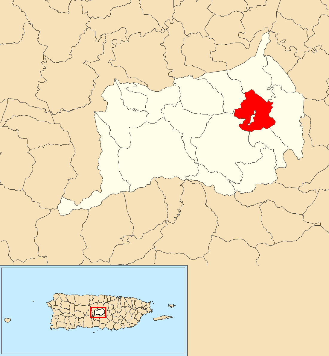
Locator map of Orocovis barrio, Orocovis, Puerto Rico. Map: The Eloquent Peasant / Wikimedia Commons, CC BY-SA 4.0.
According to the municipality's territorial plan, Orocovis borders Ciales, Morovis and Corozal to the north, Barranquitas and Corozal to the east, Villalba, Coamo and Juana Díaz to the south, and Ciales to the west. The 2020 Census counted 21,434 residents in its 17 barrios. The Census Bureau's 2024 Gazetteer gives its land area as 164.8 square kilometres (63.6 square miles).
Watch: What to do in Puerto Rico? | Visit Orocovis, Barranquitas, and the Central Mountains — The Destination Dudes.
How the Town Began
Orocovis began as Barros. According to the municipality's territorial plan, residents of the Barros district of Morovis and the Orocovis district of Barranquitas wanted a town of their own, and gave power of attorney to Juan de Rivera Santiago in a process begun on 25 May 1825. Governor Miguel de la Torre granted the licence on 10 November 1825. In 1928 the Legislative Assembly changed the town's name from Barros to Orocovis. According to the municipality's territorial plan, the name comes from the Taíno cacique Orocobix.
The Heart of Puerto Rico
Discover Puerto Rico, the island's official tourism guide, says Orocovis is "known as the heart of Puerto Rico" and describes it as the geographic centre of the island.
Toro Negro State Forest
Part of the Toro Negro State Forest lies in Orocovis. The municipality's territorial plan places Orocovis in the forest's Toro Negro unit together with Villalba, Ciales and Jayuya. Discover Puerto Rico's hiking guide lists six municipalities: Jayuya, Ponce, Villalba, Orocovis, Ciales and Juana Díaz. The sources also differ on the forest's size: about 7,000 cuerdas in the territorial plan, nearly 7,000 acres in Discover Puerto Rico's hiking guide, and about 3,000 acres on Discover Puerto Rico's Orocovis page. The hiking guide, updated 25 August 2026, says the forest includes the island's three highest peaks: Cerro de Punta, Cerro Jayuya and Cerro Rosa. It names two trails as open: El Bolo, which climbs to a stone tower, and Charco La Confesora, which starts at the Toro Negro camping grounds. To hike or camp, visit the ranger station first, on Route 143 at kilometre 32.4 in Villalba. Discover Puerto Rico's Orocovis page also lists the Doña Juana waterfall, beside the main road, as easy to reach and free of charge.
Watch: Highpointing: Cerro de Punta, the highest point in Puerto Rico — Rooftops of America. Cerro de Punta is in the Toro Negro State Forest, which Orocovis shares with neighbouring municipalities.
Coffee in Orocovis
Orocovis is one of the 28 municipalities listed as the coffee zone in the preamble of Ley 78 of 27 July 2019, the Ley de la Oficina de Cafés de Puerto Rico. Its coffee sector is small. Because response rates were low, the 2022 Census of Agriculture published only limited data for each municipio. For Orocovis it reports 29 farms that sold coffee in 2022. The census groups Orocovis in Region 6 (Naranjito), with Aibonito, Barranquitas, Comerío, Corozal, Morovis and Naranjito. That whole region had 83 coffee farms on 222 cuerdas in 2022. That is the least coffee land of the census's eight regions, about 1.2 per cent of the island's 18,961 cuerdas. For comparison, Region 1 (Utuado) had 7,130 cuerdas of coffee and Region 7 (Lares) had 6,553.
A cuerda is not an acre. One cuerda is 0.9712 acre.
After the Hurricanes
For the 1899 hurricane and its effect on the island's coffee, see Hurricane San Ciriaco and the Coffee Collapse (1899). Hurricane María, in 2017, destroyed about 80 per cent of the island's mature coffee-producing shrubs, according to World Coffee Research, as cited by the US Forest Service. Between the 2018 and 2022 censuses, Region 6's coffee farms rose from 55 to 83 and its harvest from 232 to 340 hundredweight, while its coffee land fell from 296 to 222 cuerdas.
Key Facts
- Founded as Barros: licence granted on 10 November 1825; renamed Orocovis in 1928.
- 21,434 residents in the 2020 Census; 17 barrios; 164.8 km² (63.6 sq mi) of land.
- Known as "the heart of Puerto Rico".
- Listed in the coffee zone in the preamble of Ley 78-2019.
- 29 farms sold coffee in 2022; its census region had 222 cuerdas of coffee, the least of the eight regions.
- Part of the Toro Negro State Forest lies in the municipality.
- One cuerda = 0.9712 acre.
Frequently Asked Questions
Why is Orocovis called the heart of Puerto Rico? Because of its central position. Discover Puerto Rico describes it as the geographic centre of the island.
Is Orocovis a major coffee producer? No. In 2022, 29 of its farms sold coffee, and its census region had the least coffee land of the island's eight regions.
Was the town always called Orocovis? No. It began as Barros, licensed in 1825, and the Legislative Assembly renamed it Orocovis in 1928.
Where do I start a hike in Toro Negro? At the forest's ranger station on Route 143 at kilometre 32.4 in Villalba, where most of the trailheads are. Discover Puerto Rico names El Bolo and Charco La Confesora as open trails.
What cupping score does Orocovis coffee achieve? No source establishes one.
Sources
- United States Census Bureau, 2020 Census and 2024 Gazetteer — the population of 21,434, the 17 barrios, and the land area of 164.8 square kilometres (63.6 square miles).
- Municipio de Orocovis, Plan Territorial, Avance (archived copy, 16 June 2023), December 2020 — the petition of 1825 and the licence of 10 November 1825; the name Barros and the 1928 renaming; the 17 barrios; the bordering municipalities; the Toro Negro unit and its size in cuerdas.
- Discover Puerto Rico, Orocovis, viewed 8 October 2026 — "the heart of Puerto Rico"; the geographic centre; Toro Negro at about 3,000 acres; the Doña Juana waterfall.
- Discover Puerto Rico, "Popular Hiking Trails in Puerto Rico", updated 25 August 2026 — Toro Negro: nearly 7,000 acres in six municipalities, the three highest peaks, the El Bolo and Charco La Confesora trails, and the ranger station.
- Ley 78 de 27 de julio de 2019, Ley de la Oficina de Cafés de Puerto Rico — the 28 coffee-zone municipalities listed in its preamble, including Orocovis.
- United States Department of Agriculture, National Agricultural Statistics Service, 2022 Census of Agriculture, Puerto Rico Island and Regional Data (AC-22-A-52), July 2024 — Table 44 (coffee by region, 2022 and 2018), Table 88 (municipio highlights), the note on low response rates, and the cuerda conversion.
- Yaneris M. Soto Muñiz, "Forest Service Helps Small Farmers Hit Hard by Hurricanes", USDA, 20 September 2019 — 80 per cent of mature coffee-producing shrubs lost, citing World Coffee Research.
Claims this encyclopedia could not source
- That the mathematical centroid of Puerto Rico falls within Orocovis, that locals place it in the barrio of Pellejas, or that a monument marks it.
- That the 1899 census recorded 14,845 people in Barros.
- That the nicknames appear in the municipality's anthem.
- That Orocovis borders Jayuya. The municipality's territorial plan does not list it.
- Which peak is the highest point in Orocovis. Sources have given Cerro Doña Juana, at 3,471 feet, and Cerro Mogote.
- That Hurricane María destroyed about 85 per cent of the island's coffee harvest, as attributed to the then Secretary of Agriculture.
- That Orocovis farms saw 60 to 80 per cent plant mortality after Hurricane María.
- That Orocovis coffee scores 84 to 88 on SCA scales, with some reaching 89 or above.
- That Orocovis coffee shows more concentrated flavour development, brighter acidity and denser body.
- That altitude ensures even unremarkable Orocovis farms produce specialty-quality coffee.
- That "Strictly Hard Bean" or "Strictly High Grown" applies to Puerto Rico, or that Orocovis farms reach those classifications.
- A coffee growing range of 2,000 to 3,500 feet, and farm sizes of 10 to 75 cuerdas.
- That Hispanic Federation or TechnoServe programmes operated in Orocovis specifically.
Related Articles
- Jayuya: Taíno Mountain Coffee
- Adjuntas: Coffee in the Switzerland of Puerto Rico
- Utuado and Ciales: Central Mountain Coffee Regions
- Villalba: Lake Toa Vaca and the Southern Coffee Slopes
- Puerto Rico Coffee Cooperatives and Economics
- Maricao: Where Coffee Meets the Cloud Forest
- Coffee Leaf Rust (Roya) in Puerto Rico: The Silent Threat
Buy Authentic Puerto Rico Coffee
Support Orocovis's high-altitude farmers by choosing coffee from Puerto Rico's central mountain heart. Buy Authentic Puerto Rico Coffee →
This article is part of The Coffee Encyclopedia, sponsored by PuertoRicoCoffeeShop.com — the trusted source for authentic Puerto Rican coffee.